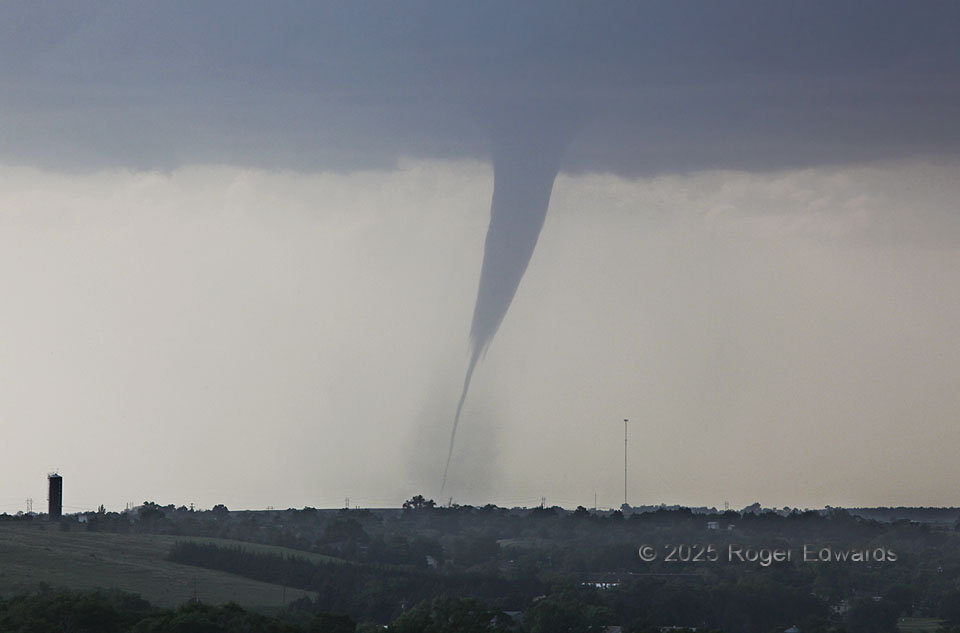
This is a deep zoom from the same hilltop location where I shot wide angles of the parent supercell with this tornado beneath. Tornadoes almost always are wider than their visible clouds, and the strong winds can extend far outside the condensation edge. The cloud just represents where pressure has fallen enough to cool air to the dewpoint locally. Here, that happened in two layers: a narrow, inner-core tube in the first few thousand feet above ground, then an outer sheath from there to ambient cloud base. The tornado was still bigger — approximated by the outer edge of the dust sheath. This (first?) “Wellfleet” tornado weakened temporarily amid its long apparent lifespan, and may even have lost its ground circulation for a few minutes just a few minutes after this. [I then was looking at it and driving toward it, but still was too far to say for sure either way.] If true, that would make the event two still-long-lived tornadoes, but there were few damage indicators to give a definitive answer. Either way, the same cloud-base circulation’s re-intensified stage yielded a tall, impressive condensation tornado as well.
2 SE Maywood NE (16 Jun 25) Looking NW
40.6335, -100.5888