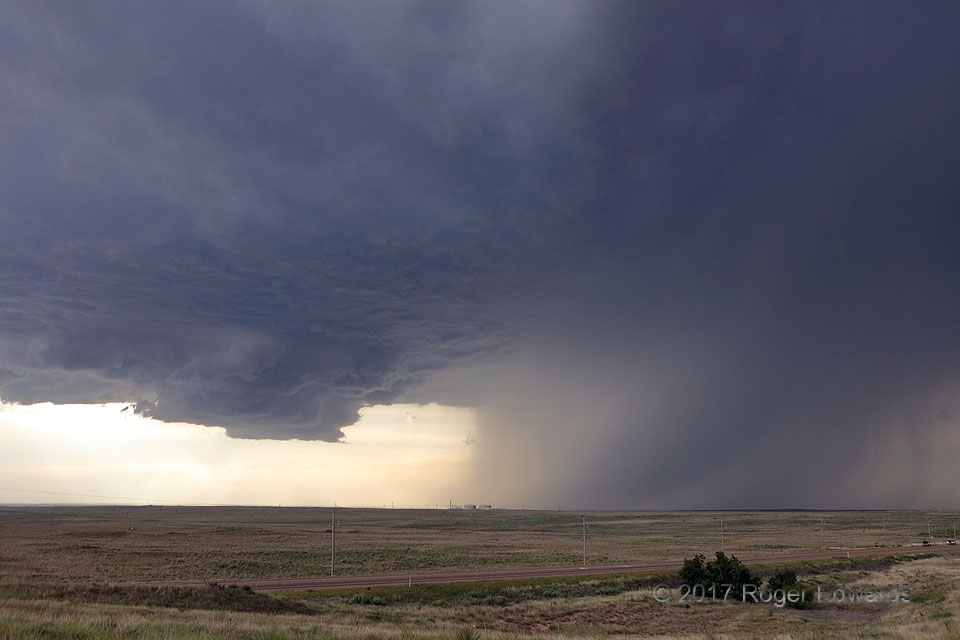
 Classic, somewhat high-based, High Plains supercell structure appears here, with the rain-free base and wall cloud at left signifying the mesocyclonic updraft area. At right, the newly mature storm’s forward-flank core delivered flash-flooding rains, strong to severe wind, and significant hail to a few square miles of the Texas Panhandle. This supercell was delivering its largest reported hailstones—baseball size—near the time of this shot, and it would continue to heave large hail, while increasing its damaging-wind output, for a couple more hours thereafter.
14 NNE Amarillo TX (8 Jun 17) Looking WNW
35.4107, -101.6354
Classic, somewhat high-based, High Plains supercell structure appears here, with the rain-free base and wall cloud at left signifying the mesocyclonic updraft area. At right, the newly mature storm’s forward-flank core delivered flash-flooding rains, strong to severe wind, and significant hail to a few square miles of the Texas Panhandle. This supercell was delivering its largest reported hailstones—baseball size—near the time of this shot, and it would continue to heave large hail, while increasing its damaging-wind output, for a couple more hours thereafter.
14 NNE Amarillo TX (8 Jun 17) Looking WNW
35.4107, -101.6354Mesocyclone Region, Forward-Flank Core
 Classic, somewhat high-based, High Plains supercell structure appears here, with the rain-free base and wall cloud at left signifying the mesocyclonic updraft area. At right, the newly mature storm’s forward-flank core delivered flash-flooding rains, strong to severe wind, and significant hail to a few square miles of the Texas Panhandle. This supercell was delivering its largest reported hailstones—baseball size—near the time of this shot, and it would continue to heave large hail, while increasing its damaging-wind output, for a couple more hours thereafter.
14 NNE Amarillo TX (8 Jun 17) Looking WNW
35.4107, -101.6354